Showing posts with label Northern Island Marine Monument. Show all posts

Sunday, October 26, 2008

DEMA Las Vegas 2008 Comes to a Close

Day four.

I awoke today feeling excited but oddly not at all for the last day of DEMA. I needed the “keep your eye on the ball” mentality today because I had a job to do. With only six hours left in the DEMA show I had to concentrate on what was at hand rather than the fact I’d soon be reunited with my family. During last nights 5-minute telephone conversation with my daughter she had told me “only five more sleeps daddy before you will open my door”. Her words were now playing in my head over and over again only the number was now four.

Time to concentrate. One day left. What’s the priority? What’s left to do? Agghhh! I could use another 4 days here. The first three have been fantastic for their own reasons and I knew today would be no different except of course it would be the last and I was feeling like a kid in a candy shop when Mom and Dad give the 2 minute warning. I had made my list and knew getting to the show floor would keep my head in the game and focused on things other than future giggles over pancakes in my own kitchen.
(DEMA Floor by Indonesia)
Zip…….. 7 hours later and DEMA is over! Just like that. The full tally of people I’ve met is not yet complete nor is my informal survey designed to find out just how many of these dive industry folks even know where Saipan is let alone how many have dove the waters surrounding it. All week I’ve talked about Saipan, Tinian and Rota to many of the leaders in dive travel, underwater imaging and marketing industries as well as training and conservation organizations. My goals were clear from the beginning.
(Annie Crawley and her very proud Mom!)

(Me and Bob Talbot - never been to Saipan)
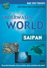
Networking with the intention to promote the CNMI, The Underwater World of Saipan DVD and my skills as a videographer. I was also here to learn from the best in terms of both people and locations including how and why they have become or continue to be successful. Finally I was determined to enter the world of still underwater photography by purchasing a housing for my Nikon D200 or perhaps a smaller less expensive option. Either way I was in need of expert advice and this was the place to find it as well as invest in the future.
(Wyland and I, yes if he looks like he is in pain he is . He just had a turtle added to his arm)

(Friends of Jennifer McKinnon and our Underwater Historical Trail)
During every interaction the discussions included Saipan and the CNMI. Among the things that brought the most interest and further discussion were the potential marine monument in the northern islands and the development of a historical underwater trail including the many WWII relics scattered around the Saipan lagoon. It should be noted here that I have now experienced first hand the beginning of what would be a very real increase in worldwide exposure should these two endeavors become reality. This is especially true for the monument as more than a few prominent leaders in this industry raised eyebrows with interest and expressed support for the concept of large-scale conservation in the region. All agreed it would be good for tourism and the planet.
(Ikelite housing - possibly)

(Sea and Sea - mmmm possibly)
As you walk parts of the floor at DEMA it’s like walking the globe. The Micronesian section takes you to Yap, Chuck, Palau, Kosare, Pohnpei. The Bahamas and Cayman Islands occupy large areas of the floor while additional Caribbean destinations have smaller booths nestled together according to geographical location. The same is true for Asia including the large set-ups from the Philippines, Indonesia and Australia. North and South America are well represented especially California and the Florida Keys. Within each section are individual operators and resorts looking to stand out from the rest by offer something no one else has or fulfilling a local need.
(Jeff, a good Canadian putting us on the world map with the Diving Almanac)

(Joey who knew where Saipan was!)
(Wendy and Jason Heller from ....... DivePhotoGuide.com)
At the end of the day my opinion that the diving in the Marianas deserves discussion among the most popular dive destinations around the world holds true. Ultimately Mother Nature has delivered the necessary features and diversity for us to become popular with divers around the globe but at the same time the level of success for our dive industry is dependent on effective marketing and delivery of a positive experience for all who visit.
(The Put Another Dollar In - PADI booth)
No doubt improvement in both these variables is needed especially outside the Japanese market but at the same time increasing international awareness while improvements to service and infrastructure are made is not only possible but also proactive and necessary based on the initial response to my most popular DEMA question “Do you know where Saipan or the Northern Marianas Islands are?”
(Bill Acker from Yap)(Sam of Sam's Tours Palau)
While I believe I have done a lot to spread the good word and promote the islands of Saipan, Tinian and Rota I came up a little short in deciding upon a housing option for my still camera. DEMA was the place to put my hands on the hardware but in the end it will be getting home to my family and resuming income generation that will allow the actual purchase!
(The Wetpixel Team including Adam, Alex, Eli and Eric Cheng)
Only 4 more sleeps! This next one will go by quickly. It’s been a long four days and even though I wish I could have accomplished more I am truly happy I was able to make it here at all. I am happier still that I’m now closer to getting back to warm weather and crystal clear water only minutes away from my home.

Tuesday, October 21, 2008

My Monument Letter to President Bush

The federal discussions are now underway on Saipan. This week is the week to make public comments regarding the proposed Marianas Marine Park. (No name has been officially adopted so I'll change it up now and again.)

Anyone with an opinion is being asked to write to the president, or call your local congressperson or senator the number is 664-8999. Your opinion matters. Here's my letter to W.


October 20th, 2008


George W. Bush
President
1600 Pennsylvania Avenue
Washington, DC 20500


Dear President George W. Bush,

My name is Mike Tripp. I am a SCUBA diving instructor, underwater filmmaker, pharmacist and father of two living in the Commonwealth of the Northern Mariana Islands on the island of Saipan. I write to you in support of the large marine protected area that will be created by proclaiming the waters surrounding the three northernmost islands of the archipelago a marine monument.

If my words, in any way, help sway your decision in favor of this designation then I ask that they also persuade you to do everything within your power to ensure the monument not only protects the marine habitat within its boundaries but that it also helps ensure the preservation and practice of local Carolinian and Chamorro culture throughout the CNMI.

As a Canadian living on Saipan and as someone who has traveled extensively, I am familiar with the concerns of those who feel their language, culture and traditional way of life is threatened by outside forces. In the CNMI this threat is not new nor is it unfounded; therefore, it is imperative that any governing body tasked with regulating the monument area have strong representation by local indigenous people whose ideals are in line with those of their ancestors and whose actions will uphold the high value of conservation passed down from generation to generation.

At the same time I ask for you to do everything within your power to ensure creation of the monument is followed by the resources necessary to achieve the many benefits touted for local residents and the world as a whole. Without proper funding for education, infrastructure and enforcement the federal designation of a monument will be nothing more than a line on a map and one that has the potential to divide our local population.

With funding and effective co-management comes the ability to protect this vast area far better than what can currently be achieved by good intentions alone, as these are no match for foreign fishing fleets illegally poaching such a vast area so far away from the populated islands of the south. With funding comes the ability to build a world-class visitors center that will not only stimulate the local economy by creating jobs and increasing revenues from tourists, but it will also provide a foundation for marine education and the preservation of indigenous culture. With funding and effective management will come international notoriety and a sense of pride for local residents when they are recognized by the world as long-time environmental stewards and role models for effective conservation. This pride will ultimately help fuel the creation of additional infrastructure and programs required to immediately stimulate economic growth while encouraging new generations of young indigenous people to embrace their own heritage and ensure traditional ways are passed on to their children.

As a father of two children who were born here on Saipan, I feel a sense of responsibility to do what is right for future generations of islanders as well as the planet as a whole. I believe creation of a marine monument along with appropriate funding and effective management by both federal agencies and the local people provides an opportunity that should not be missed especially as a result of the few who wish to see the status quo maintained.

In closing, as an active member of the community I believe, in context of the information above, the vast majority of CNMI residents support the designation of a marine monument surrounding the islands of Asuncion, Maug and Uracas and hope that you will decide in favor of its creation.


Sincerely


Mike Tripp
President
Mike Tripp Productions


cc: Benigno R. Fitial, CNMI Governor
Pete P. Reyes, CNMI Senate President
Arnold I. Palacios, CNMI House Speaker
Dirk Kempthorne, Secretary of the Interior
James Connaughton, CEQ Chairman
Vice Admiral Conrad C. Lautenbacher, Jr., NOAA
Carlos M. Gutierrez, Secretary of Commerce
Ignacio V. Cabrera, Chairman - Friends of the Monument

I encourage everyone to take the time to write your own letter or email. Send it to the paper, send it to any government office or take it down to American Memorial Park. It does not have to be long it could be written on a napkin although paper and a pen would be preferred.

Monday, October 20, 2008

A Most Interesting Day on Saipan - A Monument Hangs in the Balance

It’s a beautiful, not too hot, not too cold kind of day here in Southern California. I have no idea what the weather is like on Saipan today but I do know it is going to be a very interesting one to say the least.

Yesterday, James Connaughton arrived on island to conduct official federal discussions with the people of the CNMI regarding the wishes, concerns and, ultimately, support for or against the creation of a large marine protected area surrounding the islands of Asuncion, Maug and Uracas.
These tiny, remote islands in the Western Pacific make up the northernmost tip of a rugged archipelago stretching over 400 miles to the south. Each of the 16 islands of the Mariana chain protrude like vertebrae on a human spine as they arch their way along the deepest part of the world, the Marianas Trench. Three of the islands are considered active volcanoes while 7 are inhabited. Less than fifty people live in the northern islands while the southern islands including Saipan, Tinian, Rota and Guam make up the population base. Politically the chain is divided but it is also united under the flag of the United States of America. The southern most island of Guam is considered a territory while the other islands, with Saipan as the capital, make up the Commonwealth of the Northern Marianas Islands (CNMI).
Uracas
Today gets interesting because after 10 months of discussion the concept of the Marians Trench Marine Monument becomes an actual proposal and the dialogue between the federal government and the people of the CNMI including local government representatives officially begins. Open to the public on Capitol Hill at 11:30 AM there will be a joint session of the Senate and House of Representatives where Mr. Connaughton, Chairman of the Council on Environmental Quality, will presumably be outlining the preliminary details of the proposal. A proposal that would see President Bush use the powers of the Antiquities Act to create the second largest marine sanctuary or protected area in the world. A proposal that has caused a lot of debate and, with significant advocacy campaigns for both sides, a certain amount of tension and distrust between those who favor and those who oppose.
Maug
Anyone who follows along with CNMI politics or who has had the opportunity to sit in on a session of the house or senate knows that this should make for a very interesting start to a long day indeed. Just to fill in anyone who’s jumping into this midstream, I’ll provide a quick run down of the highlights and how I perceive we’ve gotten to this point before jumping in with a few “fly on the wall” predictions as to how today might go down.
Asuncion
The Marianas Trench Marine Monument, as it has become known, was a concept first floated by Jay Nelson of the Pew Environmental Group in November 2007 during a public retreat designed to establish the goals of a local NGO, the Marianas Island Nature Alliance (MINA). It was stated that President Bush was looking to have large NGO’s from around the world assess potential areas for the possibility of protection through use of the Antiquities Act as was done in creation of the Papahanaumokuakea monument in Hawaii two years earlier. While MINA decided to concentrate efforts in other directions, their director at the time, Angelo Villagomez, would later become the local Pew representative in charge of coordinating community outreach and advocacy for the monument concept.
During the MINA retreat, John Gourley, a local resident, former biologist at the Division of Fish and Wildlife and advisor to the Western Pacific Fishery Management Council (Wespac), opposed the idea and would later become a leader of the movement to block the concept from being discussed. Shortly after Pew began conducting public information sessions, the CNMI legislature also acted quickly (within 24 hours of its introduction) on a resolution essentially stating they were not interested in any proposal that allowed unilateral action by the federal government. Around about the same time, Governor Fitial also wrote a letter against the idea despite never meeting with Pew representatives or hearing the concept.

From the beginning the lines were drawn. Fortunately the story does not end there. Those in favor of the concept did not give up and quickly pointed to the need for conservation as well as the potential benefits beyond resource preservation that would come with the designation including increased tourism, more jobs, positive international exposure and higher education for local residents. The opponents pointed to a “takeover” of the waters from the local people and a loss of commercial fishing and mineral extraction rights across 1/3 of the Exclusive Economic Zone (EEZ). They also set out to create an “Us vs. Them” mentality with the pushy outsider being the Pew Environmental group.

Early on, opponents also attempted to sound the alarm that native Hawaiians did not welcome the formation of Papahanaumokuakea and that President Bush had forced it upon them. Pew brought William Aila, a respected native Hawaiian, to Saipan where he spoke about the indigenous Hawaiians asking President Bush to declare the monument. In doing so he said Bush had ended the government infighting and pro-fishing lobbying that had prevented Hawaiians from achieving the additional protections they desired.

Next came the argument that the designation would prohibit indigenous people from ever visiting the islands and that restricting 1/3 of the EEZ from any potential extraction of minerals or fish in the future would spell disaster for the local economy. Pew commissioned an economic study and like every economic study it was based on assumptions that could be argued one way or the other, but in the end it showed the immediate and long-term positive economic boost that would come from increased federal funding and increased tourism. At the time Aila also assured local fisherman that in the case of Hawaii, it is local Hawaiians that decide who is issued permits for fishing. So, although there were restrictions, it is not entirely prohibited and he encouraged people of the Marianas to demand a seat at the table when negotiating any rules or regulations for their own monument.

Another point of contention is the debate over who owns the rights to the waters surrounding the three islands. While the courts have ruled in favor of federal jurisdiction from the high water point out to 200 miles, many in the CNMI believe the issue of submerged lands is ongoing and that agreeing to the monument will officially give up what is theirs. However, many recognize that creation of the monument along with a co-management agreement including participation by local government would give the people of the CNMI a stronger position in the regulatory process while providing much needed funding for properly managing such a vast area of water.

In June just before I had to leave the island for my heart condition, a small group of local residents was formed. The Friends of the Marianas Trench Marine Monument (FMTMM) believed in the concept Pew had brought forward but realized the organization had not necessarily handled the delivery appropriately under the circumstances. They also realized that the opposition was spreading misinformation while attempting to put a stop to any real discussions before they got started. The Friends set out on a campaign to educate and discuss the issues as well as the potential benefits with the people of the CNMI. Over 5000 signatures and numerous support letters later, the group has grown and by all reports I get from the ground it seems they have been successful in gaining considerable support for the Marine Monument. This, while what seems like a few with a vested interest in the status quo, continue to oppose the idea based on the loss of potential commercial mining and fishing rights as well as the change in administrative jurisdiction. They continue to push the idea that no help is needed to protect or study this vast area of water despite the current lack of funds and personnel to do so. They point to past “effective” fishery management by local agencies through Wespac and the Magnuson-Stevens Fishery Act as reason enough not to consider any type of large marine protected or no-take zone in the area. It is interesting to note that should a monument be designated there will be a change at the Federal level with regards to who manages the proposed area. As it stands now jurisdiction falls under the NOAA fisheries division, of which Wespac is an advisory body. If the monument becomes reality governance will be co-managed with the lead federal agency shifting to the NOAA Sanctuaries program where Wespac has little influence. Local input and co-management responsibilities will likely mean changes at the local DFW offices as well and perhaps even the creation of a new local agency all together.

So, with much at stake and both sides firmly believing they are right, a whole bunch of people will show up this morning when discussions about the monument officially begin in the Senate chamber. No doubt on one side of the room will be Angelo Villagomez and Jay Nelson alongside the Friends in a sea of orange. On the other will be John Gourley, Sylvain Igisomar and other representatives of Wespac and DFW. I predict all or most of the government officials will be present and the room will be full. The press will be there. Jacqueline from the Saipan Tribune will get a great front-page cover shot for tomorrow’s paper. Chris Nelson or one of the KSPN reporters will be there with their video cameras trying to capture the scene including an interview with at least one of the Senators and Mr. Connaughton himself. Then later today there will be a press conference at the Friends of the Monument office in Garapan where support signatures will be officially turned over to the federal government. Finally at 5:30 tonight a public forum will be held at the Aquarius hotel. The room will again be packed with supporters in orange and those against (I’m not sure what color they will wear). There will be tension. There will be angry accusations. There will be many trying to sound intelligent but in the end many will likely ramble on. They will run out of time and then everyone will go home.

That’s as far as I wish to predict. I don’t believe Angelo and John will go for beers together afterward but I’m confident Angelo will have at least one among a group of dedicated people wearing orange.

Stay tuned for a full report!

UPDATE - The Day After.

An excellent story in the Tribune today. 'CNMI may regain control over its submerged lands'
Another Tribune story on the petition hand over. '5,502: A monumental number'
And Another Tribune article about Friends & Style 'Monument backers sport orange ahead of forum"
Jane Mack has written her take on the public forum.

Other articles and Links from the past 24 hours or so..
Amazed and Proud
Thanks for supporting the monument plan
The WOW of MMM
DFW arguments for marine monument
Angelo's Blog and Updates


The following are links to additional articles I've written about the Marianas Trench Monument in chronological order. Those with an * have been published in the Saipan Tribune and Marianas Variety.

April 25th 2008
Act Two - Northern Island Marine Monument

Friday, May 9, 2008
Marine Monument - Why Kill It Now?*

Monday, May 12, 2008
Marine Monument – Personalities & Politics*

Wednesday, May 14, 2008
Marine Monument - Lets Talk eh!*

Friday, May 16, 2008
Marine Monument - The Benefits / It's Not All About the Fishing*

Thursday, May 22, 2008
Marine Monument - Get Informed

Friday, May 23, 2008
Marine Monument - Ruth's Round Up

Saturday, May 24, 2008
Bush Eyes Unprecedented Conservation Program - NPR Report


Monday, July 14, 2008
Coral Triangle Meet the Trench Monument

Friday, July 18, 2008
Pew's Role Defined

Saturday, October 11, 2008

Open Houses on Potential Marine Conservation Areas

Washington, D.C. – The Federal government has organized a series of open houses to discuss the advisability of providing additional recognition or protection to the historic and scientific qualities of three specific marine areas in the Pacific. These public discussions were scheduled in response to President Bush's memo to members of his Cabinet asking them to assess and recommend the appropriate future course in these three marine areas. The open houses are open to the press.

Saipan, Commonwealth of the Northern Mariana Islands
Monday, October 20th 2008
5:30pm – 7:30pm
Fiesta Resort Saipan
One of these three areas includes the 3 northern most islands in the Marianas chain. The proposed Mariana Trench Marine Monument would become the 2nd largest marine protected area in the World. As Jean-Michel Cousteau discuses in his special to the Saipan Tribune these waters are special, with rare species, active volcanic seamounts, and two continental plates colliding at the deepest of depths in the Marianas Trench.

Federal officials have been discussing the concept on Saipan for about a month. The Pew environmental group has been on island for months engaging people in discussions and providing information about the concept. This open house will be an opportunity for public comment directly to the Federal officials. Below are links to blogs & websites that have additional information and commentary as well as a series of links to all the comments and articles I’ve written on the subject.


Friends of the Monument
Angelo’s Saipan Blog
Ocean Legacy Project
Lil Hammerhead
The Division of Fish & Wildlife
Jane Mack

Click this link for a whole bunch more articles and stories!


My Articles:
April 25th 2008
Act Two - Northern Island Marine Monument

Friday, May 9, 2008
Marine Monument - Why Kill It Now?*

Monday, May 12, 2008
Marine Monument – Personalities & Politics*

Wednesday, May 14, 2008
Marine Monument - Lets Talk eh!*

Friday, May 16, 2008
Marine Monument - The Benefits / It's Not All About the Fishing*

Thursday, May 22, 2008
Marine Monument - Get Informed

Friday, May 23, 2008
Marine Monument - Ruth's Round Up

Saturday, May 24, 2008
Bush Eyes Unprecedented Conservation Program - NPR Report


Monday, July 14, 2008
Coral Triangle Meet the Trench Monument

Friday, July 18, 2008
Pew's Role Defined

Sunday, September 21, 2008

The Salton Sea and Conservation

Last week Denise and the kids went back to Saipan so my Sister in Law and I headed for the desert. Final destination, Indio California, just south of Palm Springs where Nana had a week to give at the new Worldmark timeshare. The digs are certainly comfortable even if the surroundings are a bit frustrating to look at.
It’s a great pool complete with lazy river but I can’t swim yet as my incision and chest tube holes are still healing. We’re surrounded by golf courses but that’s not an activity I can participate in right now either. I like to golf and it would be good exercise but I’m not going there just yet especially after yesterday.
My exercise over the past days has consisted of a few twenty to thirty-minute walks when the temperature has allowed mixed in with a lot of recuperating on the couch; TV remote and laptop in hand. The time had come to check out the desert landscape beyond the crest of urban sprawl as seen from our fourth floor vantage point.
Destination, The Salton Sea, California’s largest lake. With an interesting past and unknown future, I came across this unique area of the planet during a fly by on Google Earth. A Google search for Salton Sea quickly brought me to the State Park website and a few interesting articles including this one from National Geographic. Not more than 30 miles south we could check out the shores and visitor’s center in less than a day. Off we went.
It’s a bit of a sight. I can’t drive for at least another 3 to 4 weeks. Nor can I sit in a seat with a deployable air bag. I can’t imagine how much that would hurt! Sneezes are hard enough right now. We can’t figure out how to turn off the one in the front passenger seat so I get the back. It may look like fun to have a chauffeur but I can’t say I’m crazy about the arrangement although it did allow me to snap a few shots along the way.
All around are signs of a human takeover of the desert. Water sprinklers and irrigation systems feed crop after crop including rows of towering date palms. The typical residential and commercial developments all too common in today’s urban planning projects protrude into the sand and farms like coral fingers on a submerged fringing reef. Except for the dropback of the arid Santa Rosa mountains these condos, grocery stores, Walmarts and Starbucks combine to look like any other community that’s gone up in the last 10 years.
The Salton Sea is unlike any other! Two hundred and fifty feet below sea level and covering 35 by 15 miles of real estate on top of the San Andreas fault line, this body of water has come and gone over the years at the will of the Colorado River and the effects of man. It now exists as a result of the last flood in 1905 and the irrigation run off from surrounding agricultural areas. However, with water deals for San Diego diverting liquid gold from its source and extreme desert temperatures, the water levels decrease while salinity increases.
(They could use some help from BCNMI)
Water levels have receded leaving a wasteland of rotting bones, barnacles and salt where tourists once flocked. Despite the harsh conditions millions of fish including the tasty tilapia thrive even with intermittent mass die offs. With 90% of California’s wetlands destroyed over the years, millions of migratory birds utilize this last remaining resting spot along the pacific flyway. If the lake dries up what will happen to over 400 species of birds, many endangered? If the lake dries up experts predict the sediments, which contain heavy metals and pesticides from the surrounding developments, will be whipped up by high winds turning the Imperial Valley into a toxic dust bowl much like what happened at Owens Lake in Nevada.

Our tour of this amazing and much debated place included two stops. One at a place called “A Beach Made of Fish Bones” where a short walk quickly revealed that you cannot wear zories and kick up sand here. That’s just not sand. It is in fact sharp remnants of fish bones and barnacles AND it hurts when it gets between your shoes and your feet.
We saw many, many dead rotting fish and plenty of pelicans swooping all around or keeping their distance while afloat on the dark surface. Everything is coated with thick layers of salt, a testament to the fact the lake is 25% more salty than the Pacific Ocean.
At the state park we read informative signs while watching fisherman line the banks with rods in hand. We also took in the very informative and air conditioned visitors center including a revealing documentary on the lakes history. I even spent 40 bucks on souvenirs. This information center educates residents and tourists as to the plight and importance of the lake. It should be a mandatory visit for everyone especially if you are in any way responsible for putting pressure on the lake’s very existence. If you live in Southern California you fall into this category!
(One more American educated as to where Saipan is - she favors the monument proposal!)

On the way back to the swimming pools and golf courses surrounding our accommodations it is hard not to be concerned about human consumption and its effect globally. The waste here is so obvious with excessive lighting and expansive landscaping. With so many places on earth under stress I can’t help but think about how happy I will be if the Mariana Trench Monument becomes a reality and I can one day walk through a visitor’s center that brings revenue to the local economy and perhaps more importantly educates millions of tourists as to the importance of our oceans and conservation in general.

Unfortunately, soon after returning to our pad the aches and pains in my chest from absorbing many starts and stops in the car far outweigh any worry I have about the environment or anything else for that matter. It was good to get out and about but I’m a ways off from strapping a tank on my back!

Where’s the Tylenol!

Friday, September 19, 2008

Friends of the Monument PSA

Friends of the Marians Trench Monument began running a public service announcement yesterday following appearance by members of the group on the locally broadcast John Gonzales show.

It's now also been picked up by the Discovery Channel website here.


What would you want the monument and regulations to look like?

This is the question that the Friends of the Monument are being asked now that the feds are here to open up the dialogue.

For a long time the opposition has been suggesting that the people of the CNMI will have no say in the monument and that it will be a unilateral set of rules imposed by the feds. My understanding is that nothing could be farther from the truth. Representatives from the federal agencies involved with assessing the appropriateness and viability of the CNMI monument are now on Saipan in an attempt to ensure the best possible result and that local concerns / needs are addressed should the monument concept move forward.

Friends of the Monument are now being asked to draft a wish list of things that MUST occur in order for us to support the monument as well as a list of things YOU WOULD LIKE TO SEE.

I’ll take a stab at a start here but would like to get your thoughts too so please leave a comment with any additions.

I would NEED:
*Federal funds
*A visitor’s center on Saipan
*A ban on commercial fishing and mineral extraction
*A Co-management regulatory body with representatives from the CNMI (including but not necessarily limited to DFW, CRM and DNLR) and the NOAA Sanctuaries program.
*A mechanism that would allow limited, regulated access including sustainable fishing for indigenous peoples and the opportunity for limited ecotourism including diving charters.
*A federal funded Mariana Trench marine science curriculum within the public school system (for grade 7 students as an example).
*The boundaries to be drawn based on the best available science that will ensure the greatest opportunity for success of ecosystem based management.

I would LIKE TO SEE:
*A visitor’s center or satellite center on every island
*A federally funded cultural summer camp.
*Creation of informative advertising and educational collaterals for use by the Marianas Visitors Authority and the public / private schools.

How about you?

Wednesday, September 17, 2008

Contributor Scubatripp - My Pledge

I just finished writing a post over on the new Friends of the Monument blog. I talk about my background and why I support the monument concept as well as what I intend to do in order to try and help the people of the CNMI obtain something that will improve the economy while ensuring the protection of renewable resources for generations to come.

If you would like to read it please click on this link - Contributor Scubatripp - My Pledge.

Tuesday, September 2, 2008

Southern Cal Road Trip and the Marianas Trench Monument

It’s Carnival of the Blue time again. Angelo’s hosting it on his blog so I figured I’d try and help him out with some content. Besides, last time I submitted a post for it I happened to be awarded the editors choice for my piece about the big fish.

Today I’m going to take a few moments from my open-heart surgery theme and get back to the concept of conservation. There’ll be no discussion about bodily functions or painful incisions or even cute nurses in this one! In a way today’s post does relate to my recent ordeal as its something I’ve wanted to write about since experiencing the beauty of the southern California coast during my “alone” time just prior to going under the knife.

Soon after we got word that I needed my tricuspid valve repaired my wife and children all got sick while staying in the small downtown LA hospital guesthouse. It was imperative that I did not catch what they had and we also needed to get our kids to grandmas and grandpas since they would need to be in good hands while Denise and I dealt with what was to come.

So when they all flew to Canada the words ROAD TRIP echoed in my ears. I’ve always wanted to see San Diego and the coastline between there and LA so after picking up the car and a bunch of maps I was on my way. Just my camera and me. No set plans, no one to answer to, no chance of getting lost, as taking a wrong turn would only mean a different experience than the one originally planned. The freedom to do as I wished when I wanted to was exactly what the Dr. ordered and something I’ve not experienced in a long time.

I’ve done similar road trips in my life prior to getting married and having kids. Two similar ones come to mind and have bearing on what I plan to illustrate today. In 1997 I did a trip up the East coast of the USA from Philadelphia to Gloucester including stops in Boston and the Cape Cod. In 2002 I had the opportunity to travel the Great Ocean Road west of Melbourne Australia, an amazing stretch of scenery famous for things like the Seven Apostles. Images of both trips are ingrained in my head not only because of the beauty encountered and the untouched picturesque scenes I was able to capture on film but also because they brought me to the edges of the earth where I was fortunate to experience nature as it has existed since, well, ever since.
In all three cases the ability to witness nature essentially untouched by human hands was only possible because someone, somewhere along the line, recognized that these areas needed protection from our own destructive forces. In all three cases local, state and national parks, refuges and protected areas allowed me access to places with untouched vistas and landscapes.
This is especially true for the American treks since large human populations often encroached these areas from all sides. Without some sort of protection they would have easily been swallowed up becoming, at the very least, inaccessible and at worst destroyed forever.
As I unfolded the California state map I quickly put an X on what is essentially the southwestern most point of the USA, Point Loma and Carbrillo National Monument.
Yes I know you could get further south by heading to the boarder of Mexico but not without going though the city of San Diego and with a limited amount of time I just didn’t want to spend it doing that. I also decided to skip the beach cities around LA on the way down and hit them on the way back. So I headed south on the I5 and along with thousands of other people hit speeds twice and three times that which is possible on Saipan. At San Onofre the freeway begins to hug the coast and it becomes easier to access beaches and view points overlooking the Pacific. I’m a water person and every trip such as this is spent making turns and taking exits that hopefully lead to the horizon with nothing but blue water underneath. At Oceanside I turned off the freeway and continued south along the Coast Highway, the closest major route running parallel to the ocean. This road passes through a number of different communities each it seemed with three common characteristics: a town center, a low-lying stretch of highway with easy beach access and an elevated stretch with only pockets of spots where the vista could be accessed due to the build up of housing etc.
With each, if it were not for parks preventing development, I’m sure that every square inch of real estate fringing the cliffs and beaches from San Diego to LA would have been swallowed up giving only the owners and their lucky friends the ability to access the water and experience the amazing views carved out over time.
Have you ever been on an adventure, not really knowing where you’re going or how to get there and realizing that “over there” behind all those homes there must be a really great view. It can be extremely frustrating at times especially when you think in context of how our grandparents (or perhaps their grandparents) probably never had such a problem.
Back in the old days access difficulties would have been more related to lack of infrastructure and the pioneering skills needed to make your way through virgin territory. I’ve always been grateful to the planners of communities who’ve had the forethought to set aside areas and parks where the common folk don’t need to worry about being wealthy or having connections with locals in order to take in the view.

Thankfully along this southern drive, intertwined with all the human developments, there are numerous places offering outsiders and locals alike amazing lookouts and access to sandy beaches where surfers and sunbathers dot the transition from land to sea. In some cases such as state run parks there is a daily or weekly fee. In others the real trick is in finding a parking spot for the seaside public park. In others the location is reserved for campers and RV’s but the bottom line, despite the frustration of often needing to fork out 5 or 10 bucks, access is possible to those who seek it.
Arriving at the entrance to Carbrillo National Monument I paid my $5 fee and was happy to learn that 80% of it stays right there to support park programs and should I have the time to do so I would be allowed access for the following six days.
Unfortunately I only had one afternoon but I can safely say if I ever find myself back in this area again I will plan on taking several days to take in everything this place has to offer. From hiking trails with interpretive signs to lighthouses, tide pools and a multifunctional interpretive center you would be hard pressed to see it all in less that a couple of days and that would only be possible if you did not take the time to stop and enjoy the amazing views over looking the pacific and San Diego.
Thousands if not hundreds of thousands of people take in this protected area every year generating not only millions of dollars in revenue but also leaving visitors educated and revitalized by the beauty of what nature has created.So how does this all fit in with the Carnival of the Blue. Well although many land based parks, refuge’s and monuments have been set up around the world to allow limited human access while protecting terrestrial based resources, endangered species and unique ecosystems the same can not be said for our worlds oceans especially on a relative scale when you consider they make up over 70% of the planet.

On a grand scale the proposed concept of the Marianas Trench Marine Monument provides a unique opportunity for us to protect a body of water large enough so as to have a real positive effect on preserving the worlds oceans as a whole. It also provides an opportunity through the development of infrastructure and educational resources to change the make up of the local economy and skill set of our local people.

With establishment of the monument will come a world-class interpretive center and other revenue generating opportunities desperately needed by the local community? With increased press and notoriety the tourism sector will prosper providing jobs and income for a wide range of local residents. Through national parks programs directly funded jobs will be created and educational opportunities including increased scientific voyages will follow. These scientific expeditions will include international and local scientists eager to study the pristine area over time. Also, in a similar way to the land based parks I experienced on my drive south, future generations of tourists and locals alike will be able to travel to these remote areas knowing they have access to waters that exist in the same state as they did when their ancestors were alive. The ability to witness Mother Nature as it was intended to be will live on for future generations.
On the flip side imagine the great loss if none of the coast line from LA to San Diego was open for public viewing in its natural state. How many tourists would come? How much revenue would be lost from non-existent visitors centers and souvenirs sales including T-shirts and key chains. Imagine if none of the state park fees went to educational programs or interpretive signs. My trip down south would never have been the same, in fact it likely would never have happened if it not for the fact that someone, somewhere along the line saw the value of setting aside vast areas for the enjoyment of future generations.

Imagine the loss if the people of the CNMI don’t do as so many have done before them the world over and embrace this opportunity.

The following are links to additional articles I've written about the Marianas Trench Monument in chronological order. Those with an * have been published in the Saipan Tribune and Marianas Variety.

April 25th 2008
Act Two - Northern Island Marine Monument

Friday, May 9, 2008
Marine Monument - Why Kill It Now?*

Monday, May 12, 2008
Marine Monument – Personalities & Politics*

Wednesday, May 14, 2008
Marine Monument - Lets Talk eh!*

Friday, May 16, 2008
Marine Monument - The Benefits / It's Not All About the Fishing*

Thursday, May 22, 2008
Marine Monument - Get Informed

Friday, May 23, 2008
Marine Monument - Ruth's Round Up

Saturday, May 24, 2008
Bush Eyes Unprecedented Conservation Program - NPR Report


Monday, July 14, 2008
Coral Triangle Meet the Trench Monument

Friday, July 18, 2008
Pew's Role Defined